Milwaukee WI
St. Paul MN
Mississippi River
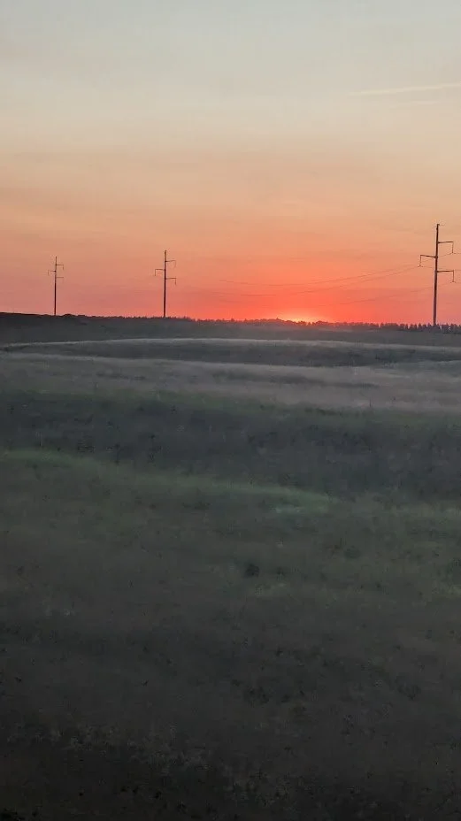
Prairie Sunset
Ray ND
Rock Formations ND
Shelby MT
East Glacier Park
Lake Wallula WA
Columbia River Gorge

Mt. Hood OR.
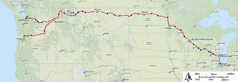
The Empire Builder
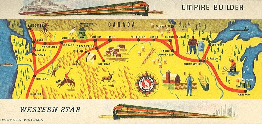
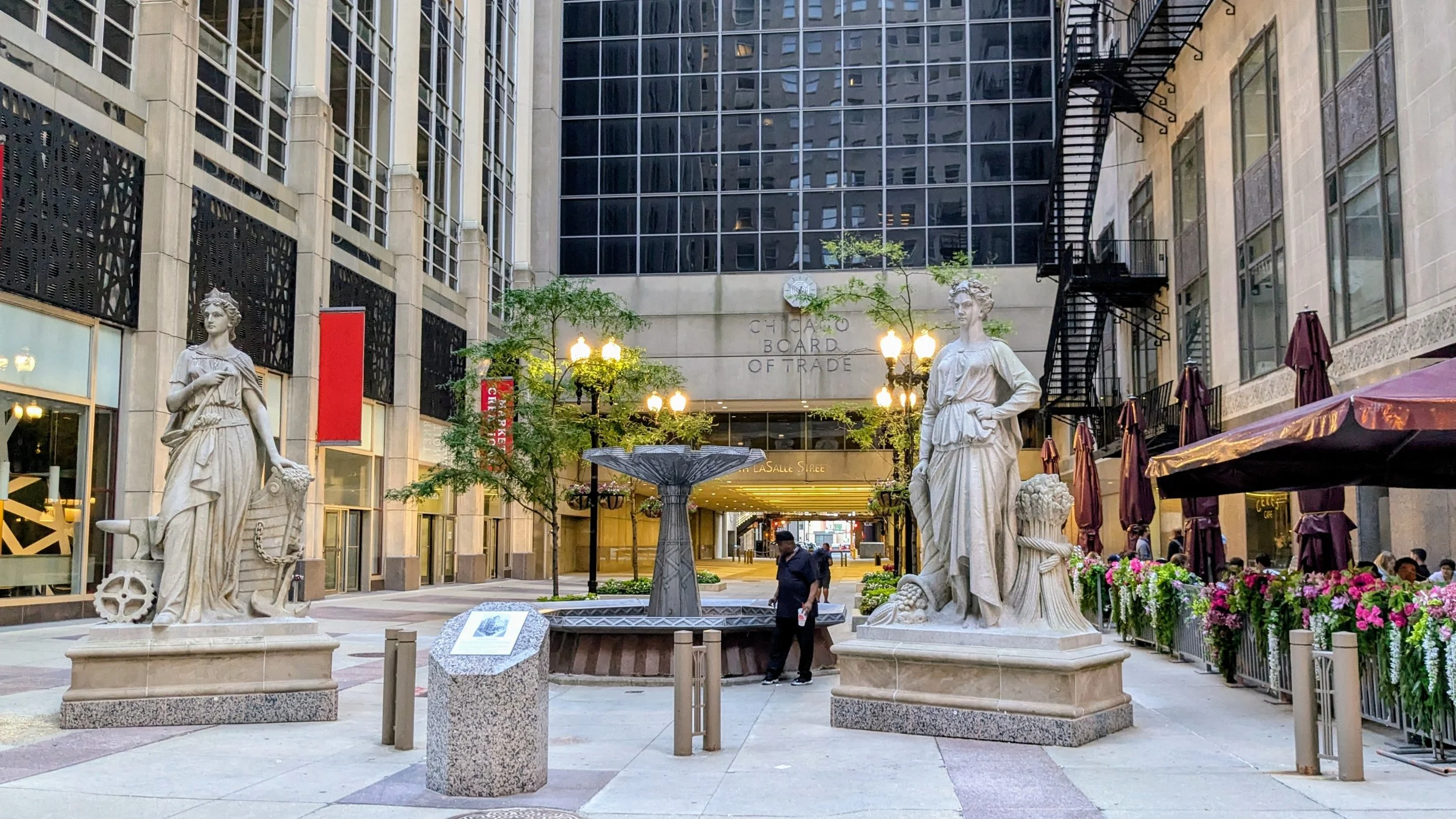
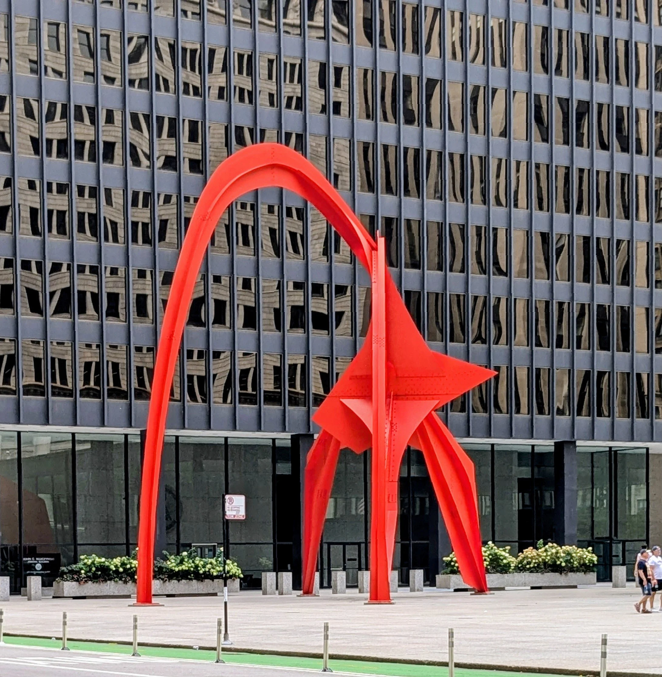
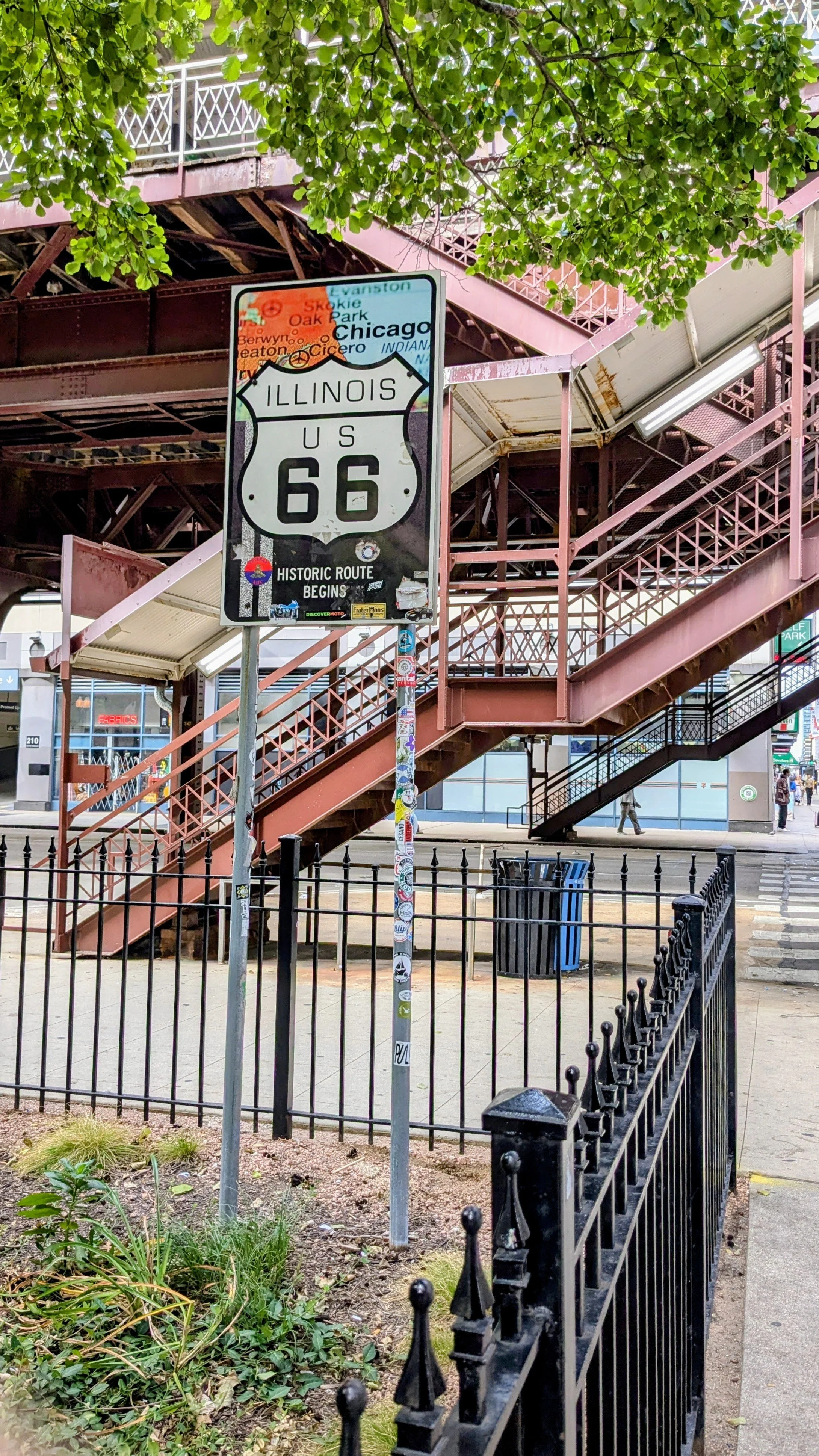
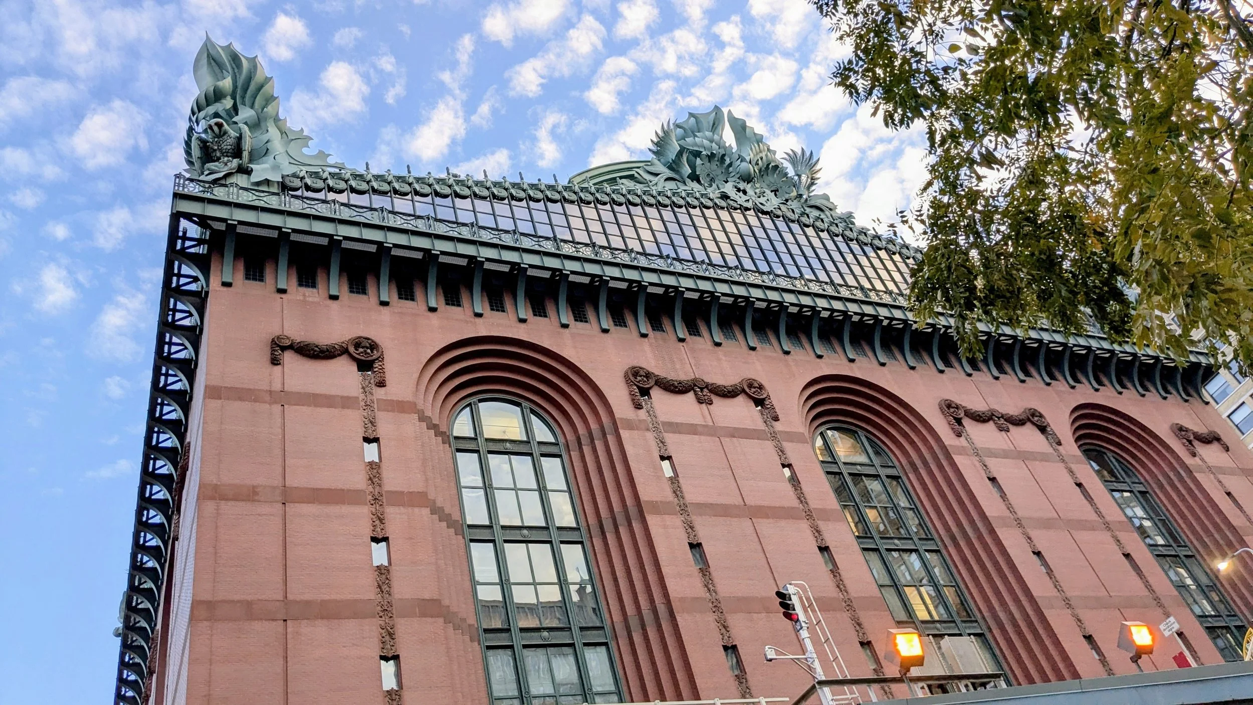
The origins of Amtrak’s most northerly route go back to 1929 and at times, follow the historic path forged by Lewis and Clark. It crosses majestic wilderness as it makes its way through towering mountain ranges, dense forests of fir, steep valleys, thundering rivers and vast prairies. I begin our journey in the crossroads of the country, Chicago. Travelling by bus from Toronto, I try to give myself a few hours before boarding the train to do a little exploring. On my last trip, I arrived at Union Stn around 7 a.m., and my train didn’t leave until 3 p.m., so I checked my bags, which you can do for a reasonable $10/day, which sure beats lugging your luggage around the city. Once that was all settled, I took a stroll to Grant Park, a 30-minute walk. My partner had advised me to steer clear of the downtown area as she had seen on the news that a large ICE protest was scheduled for that day. Promising to behave myself, I started off for the park, and of course, I walked right into the middle of the protest. There were several thousand people there with signs of every size, shape, and saying, most of them pretty straightforward in what they thought of ICE and the President. I walked through the crowd and was given a pre-printed placard, which is proudly hanging in my souvenir hutch. On into the park, which is just beautiful with an ornate entrance that holds majestic statues of Native Americans on horseback with their arrows aimed at an imaginary buffalo or foe. At the opposite end of the park is a huge fountain; from there, you get a stunning view of Lake Michigan. Heading back to the station at Adams St. and South Michigan Ave., you can see the highway sign that marks the beginning of Rte. 66, the end of which is at the Santa Monica Pier, some 2,448 miles away. On another of our train routes, the South West Chief, we will actually follow the historic Rte. 66 at times. Chicago was a huge surprise the first time I got the chance to wander its streets which have many architecturally beautiful buildings. Buildings such as the Harold Washington Library, with its facade of granite and brick with seven large, painted aluminium acroteria ornamenting the roof. Several are of owls, and several are of seed pods, which represent the natural bounty of the Midwest. On the north, east, and south sides of the building are 5-story-high arched windows. An impressive building to say the least. Another architectural marvel is the Board of Trade Building, a 44-story Art Deco skyscraper. It has an aluminium three-story Art Deco statue of Ceres, the Roman Goddess of Agriculture, that caps the building.
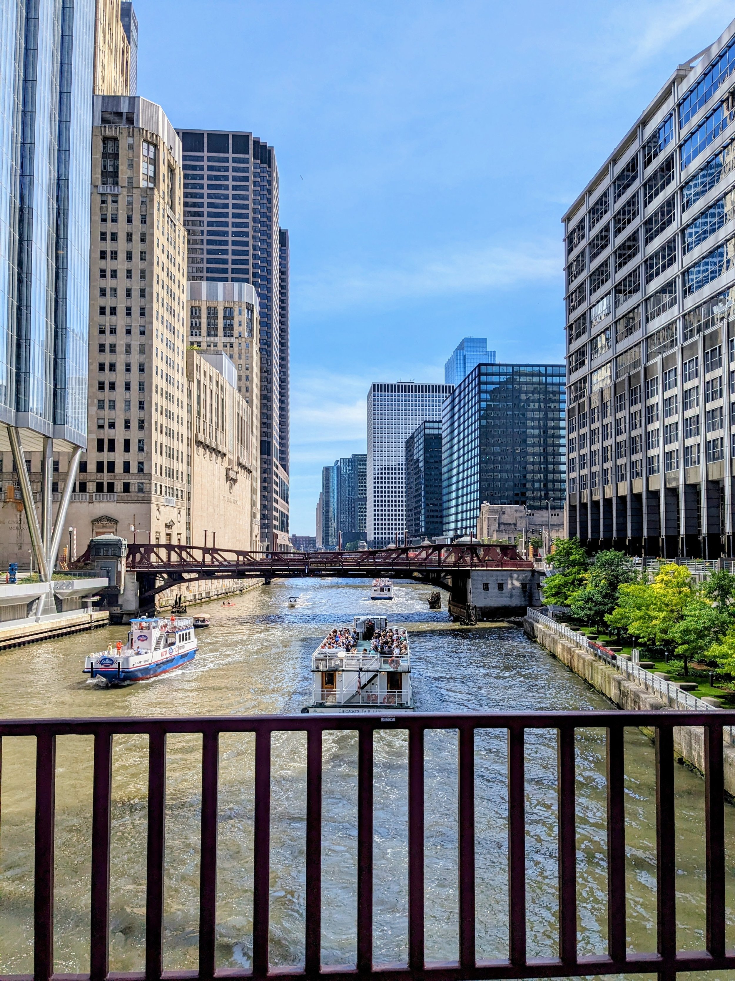
A quick stop on the 2nd. level of the Station at the food court, our final opportunity to stock up on some world-famous Chicago deep-dish pizza and a stromboli at Sbarro. One would think that good Italian fare would not be found in a place such as a train station, but trust me, I stop here every time I pass through Chicago, which is often, being it’s the ‘‘Hub’’for trains. I’m getting hungry just thinking about the mouth-watering stromboli filled to overflowing with meat and cheese, and yes, it still tastes amazing a day into my journey. Now I’m ready to board what will be a 46-hour journey. One last thing before we pull out, though, I advise you to take a good look at this station’s stunning architecture. With its marble floors, long wooden benches, marble walls with large Corinthian columns, grand staircases and opulent fixtures, it’s one of several stations along the Amtrak routes that would easily be mistaken for a museum rather than a train station. As we pull out, the Chicago River runs on the right-hand side. If you’re not familiar with this station, it can come as quite a surprise when you first glimpse tour boats full of tourists going past your window and waving at you.
This train has 2 options for a final destination if you travel from East to West. You can either depart in Seattle Wa. or Portland Or. both trips taking the same amount of time. I have done both and have also travelled in the opposite direction, going from west to east. I flew to Vancouver, took the Amtrak train to Seattle and then crossed from there. Last year, I began my journey in Chicago and went west to Portland. I would definitely recommend the west-to-east trip, as you are travelling through the Rockies during daylight hours. You do, however, miss the beauty of southern Washington and northern Oregon, which you only get to see if you’re travelling from Portland Or.
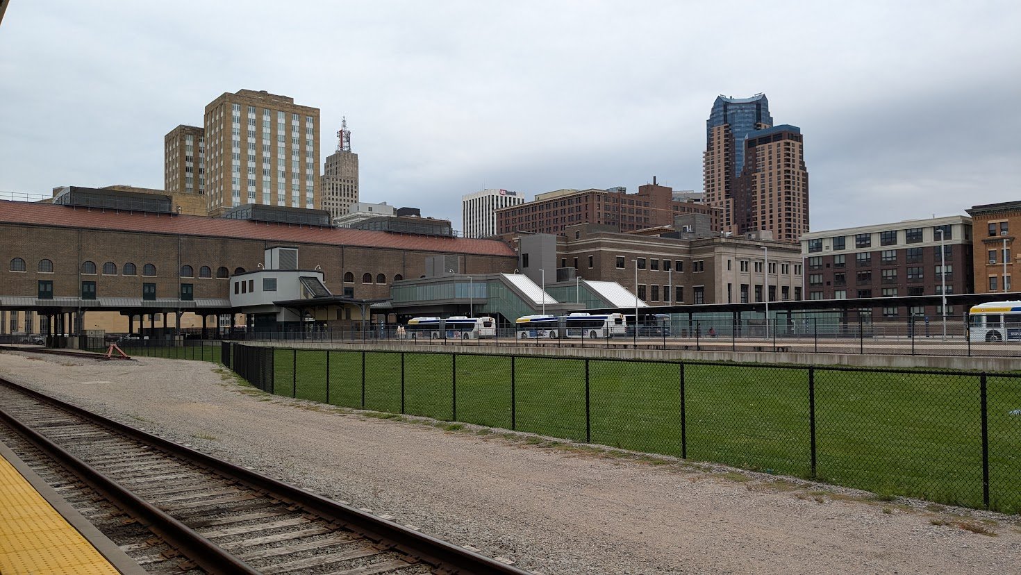
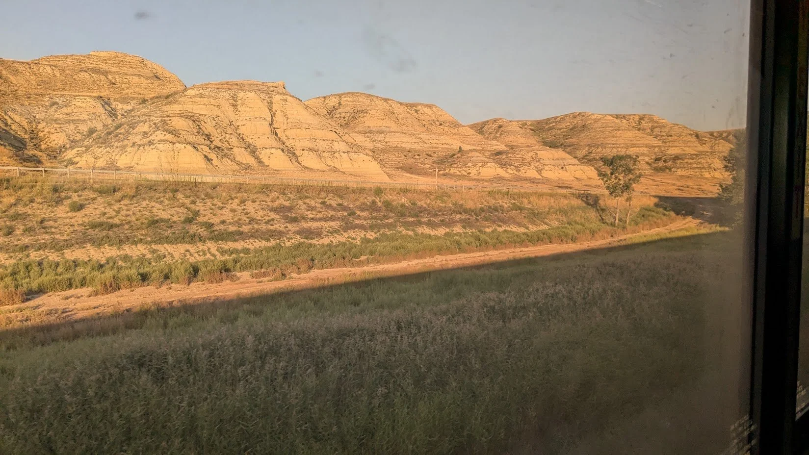
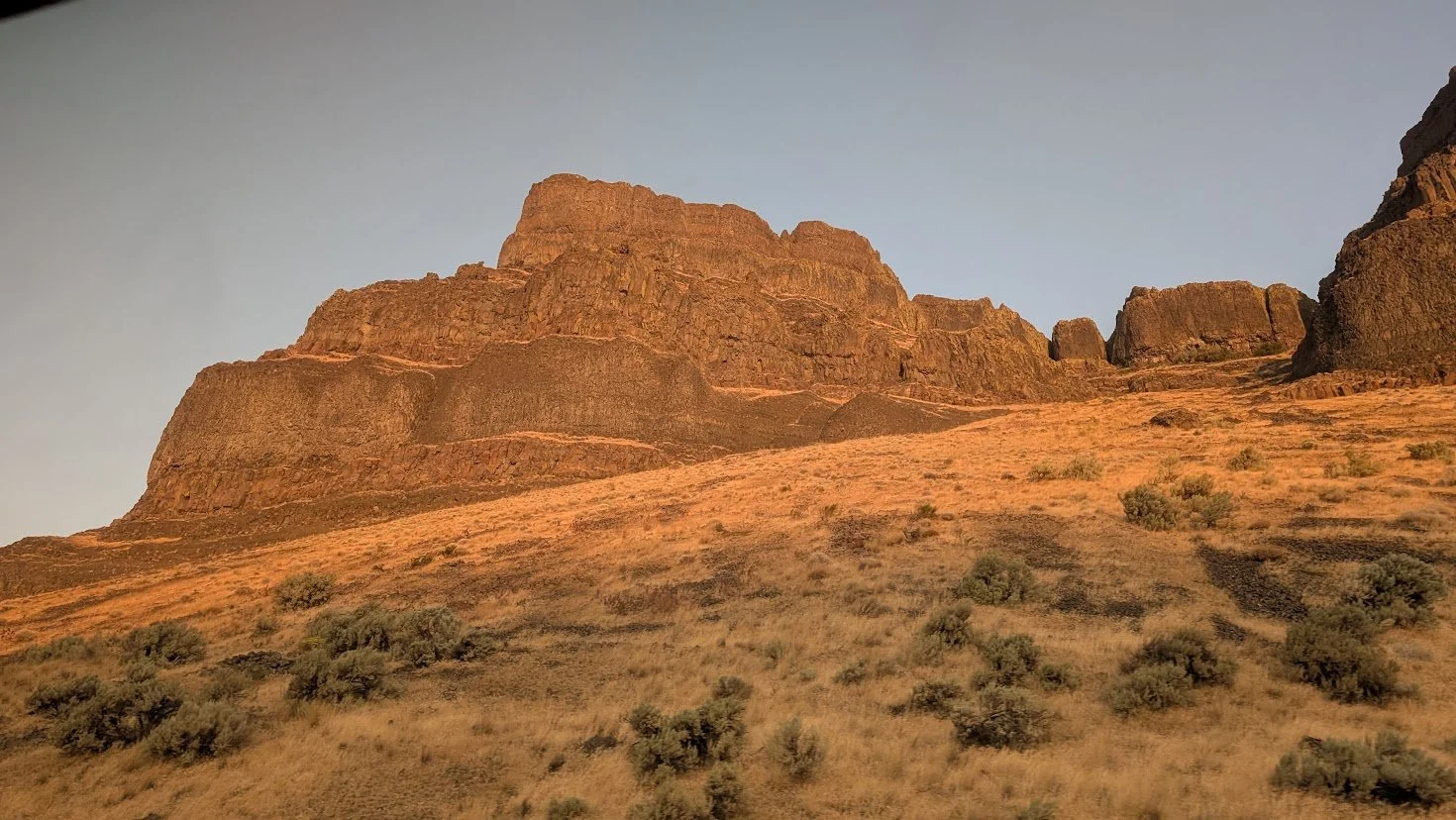
After departing Chicago, we will follow Lake Michigan into Wisconsin and the city of Milwaukee or ‘‘Brew City’’. This is normally our first ‘‘fresh-air break’’ where we will have 10-15 minutes to stretch our legs and take some photos of the city famous for its beers. You can get a shot of the Miller Brewery, the only major brewery remaining in the city, while imagining the antics on ‘‘Happy Days’’ and ‘‘Laverne and Shirley.” From here, we head west toward La Crosse, where you’ll get your first glimpse of the mighty Mississippi River. It boggles the mind that, as big as the river is here, it still has over a thousand miles to go before reaching its full might in Louisiana. Now we cross over into Minnesota. It’s getting dark now, but the night isn’t over just yet. In another couple of hours, we’ll have our 2nd. and final ‘‘fresh-air break’’ of the day in St. Paul-Minneapolis, the city that was founded on the confluence of the Mississippi, Minnesota, and St. Croix Rivers and has historically been a major railroad and flour milling center. If you’re thinking of making this a ‘‘jump-off’’ spot you will find an amazing amount to see. The Minneapolis Institute of Art holds works by Rubens and Rembrandt as well as pieces from a wide variety of cultures dating back some 5,000 years. It has the famous Mall of America, the largest mall in the US and second only to the West Edmonton Mall as the largest in North America. And for any Garrison Keillor fans, we are close to the mythical town of Lake Wobegon.Our stop will be about 20 minutes this time, probably to allow for a crew change. About 4 a.m., we will pass into North Dakota at the city of Fargo (my favourite movie). As daylight comes, we pass Devils Lake, ND, and find that we have left the forests of Minnesota and entered the rolling grasslands of the Great Northern Plains, which stretch westward all the way to Shelby, Montana. During the next 800 miles, the Empire Builder passes through the grasslands that were the traditional home of the Plains Indians, principally the Shoshone, Blackfeet, Sioux, Crow, Kiowa, Cheyenne, and more. You get an idea of the immenseness of this flat farm land as it goes on and on ceaselessly for miles and miles and hour after hour, and just when you’ve had quite enough of this sort of topographical wasteland, the land begins to shift its tempo. Small hills begin to appear but not hills as we know them in the East. These hills seem to have been carved out of multicoloured rock, and I’ve got to admit I found this stretch of the journey to be one of the most amazing. I had wanted to see the Badlands, but was told that I’d have to get to South Dakota to see that sort of scenery. If this isn’t the badlands, I sure wouldn’t want to travel on a wagon train through the real deal. I just couldn’t imagine what the first settlers must have thought when they arrived here. Hopefully, the acreage they were promised if they settled in the ‘‘New World’’ wasn’t along this hardscrabble frontier. I’d be taking the next ‘‘wagongreyhound’’ back to Bavaria. This is the wonderful thing about train travel: you can just recline in your seat or sit at a table in the Lounge Car and let your imagination go to town. No need to be watching the road, and no one in the passenger seat telling you to do so. ‘‘Bob, you’re not watching the road, you keep heading towards the ditch, watch where you’re going, are you looking for buffalo again?’’ Nope, just me and my crazy, wandering mind working overtime. As we pass the town of Devil’s Lake, ND, we travel along the actual Devil’s Lake, which is a rather large lake, being some 20-25 miles in length and 10-15 miles in width with a surface area of approximately 160,000 acres. We then pass through Rugby, ND, around 7: 50 A.M., and while we can’t see it from the train, the town has erected a 15 ft. obelisk marking the ‘‘Geographical Center of North America. Now we’re beginning to see that these rocky outcrops are becoming rolling hills as we begin to cross into Montana. There are a few stretches of what we think of as ‘‘Badlands’’ type of rock formations, but they are small in comparison to those found further south. We are now following the Mighty Missouri as well as the Lewis and Clark Trail and will do so for the next 100 miles until we reach Wolf Point. Along the stretch of the Missouri River from Garrison, ND to Williston,ND the river becomes the Sakakawea Lake due to the river being dammed at Garrison. This has created a reservoir which can be 2-14 miles wide and 180-200 miles long, making it one of the largest reservoirs in the US. It is so interesting to see the lines of strata in the buttes along this section, showing the timelines throughout the ages as these were formed. Here on the Great Plains of northern North Dakota and north-eastern Montana, rolling prairie, gently undulating plains and the occasional badlands-like breaks. Due to glacial influence, the land has a soft, rolling, slightly lumpy appearance rather than the regular flat prairie look. Here we find the Missouri Plateau, which has been cut by the Missouri River system. Deeply carved valleys and river breaks, steep-sided bluffs and terraces, and layered sedimentary rock exposures epitomise this area. On the Montana side are areas known as the Missouri Breaks, where the terrain becomes more rugged and dissected.
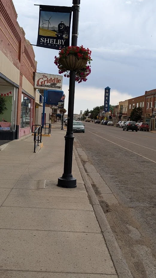
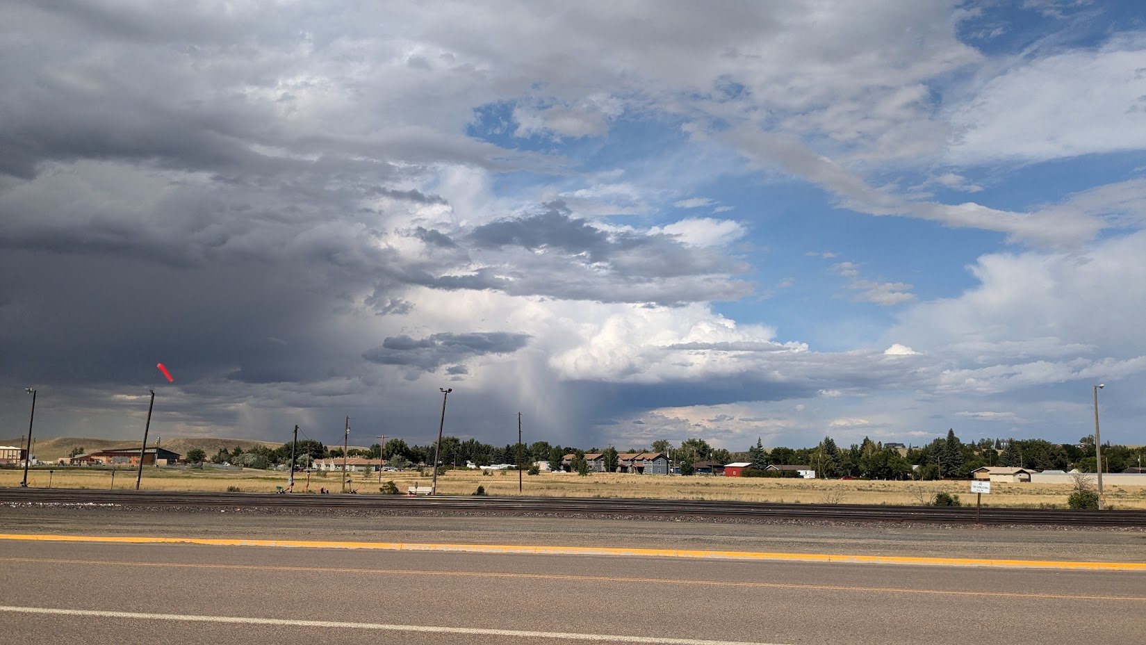
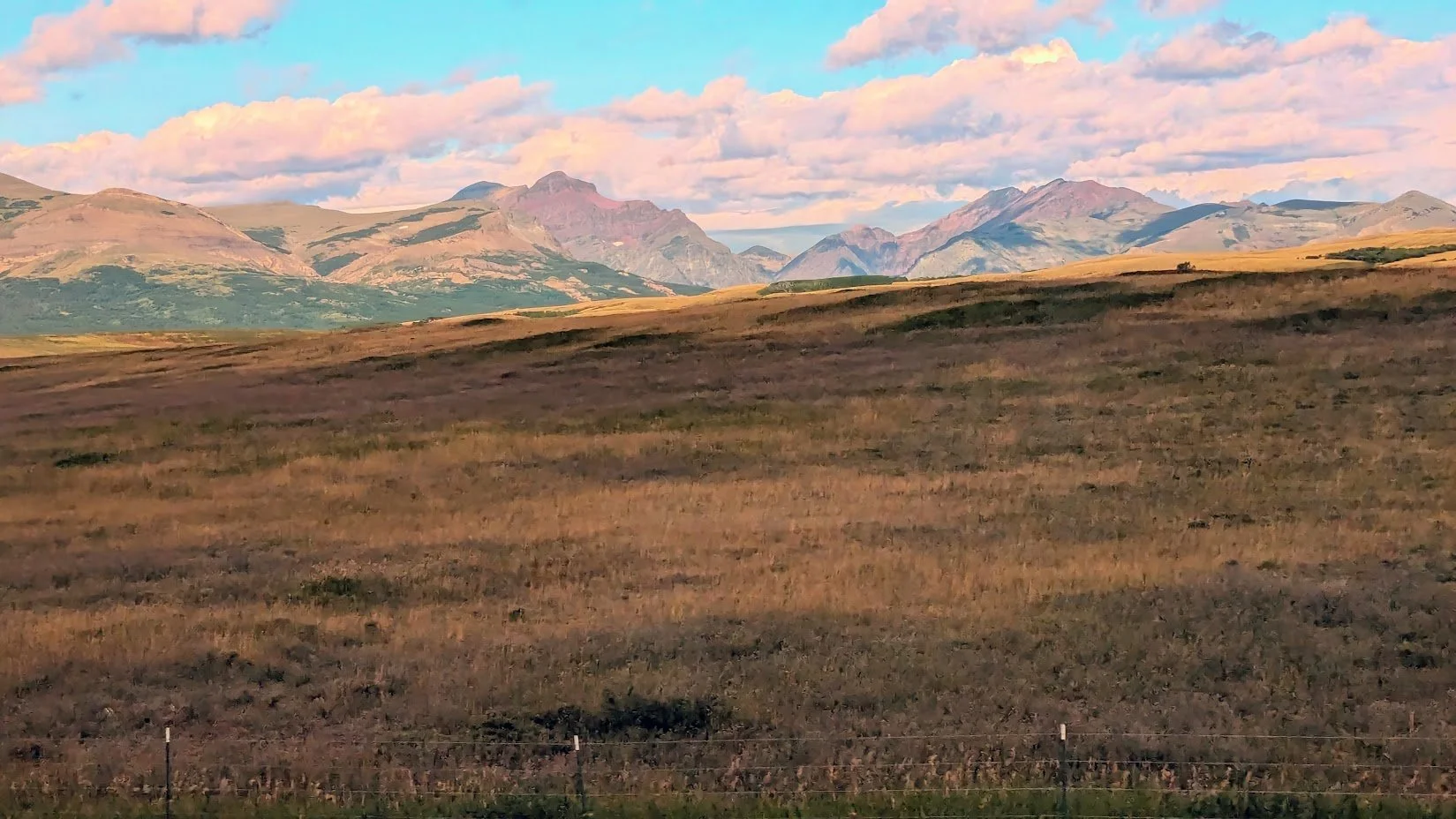
At approximately 6:15 P.M. we arrive at our one and only ‘‘jump-off’’ spot on this journey. We are in Shelby, MT. I mentioned in another blog that I spent a year here one night. Kidding aside, it is because of towns like Shelby that I enjoy solo travelling so much. I met some very nice people here who went out of their way to help a complete stranger. It all started with the Ticket Agent at the station (Dianne?), who wanted to hear all about my travels. She had noticed the state flag stickers I have on my suitcase, which now number 43. We must have chatted for a good half hour before I made my way to my hotel. Off I went on foot despite her suggestion that I should try to get a ride, maybe the hotel had a shuttle service, but I told her that I loved the heat, what was I thinking? I hadn’t gone 2 blocks before I knew I had made a mistake and misjudged my abilities. So on I trudged. A few minutes later, a man stopped to ask if I wanted a ride?? Wow, I was taken aback but declined, not wanting to look like the wimp I really am. So when I’d gone another couple of blocks and a lady stopped to ask if I wanted a ride, I didn’t hesitate to jump in. What a character she was; she must have been 90, and her truck wasn’t much younger. She was so friendly, we chatted all the way to my hotel as if we’d been friends forever. After finally getting to the hotel I dropped my bags and went back out to explore the town. I walked a few blocks and didn’t really see anything promising just one sign for a museum of some sort but it was about 500 yards uphill so I declined. I wandered its Main St. for a little while; there weren’t any souvenir shops or touristy type spots to visit, so I decided to grab some food to take back to my room. Now I’m in Montana, beef country so what do you think I got, yes, Chinese food of course, haha. Hey, it’s cheap and travels well. So back to my room, got stuffed and had a long nap. About dusk I went back out and walked around the local area. I noticed a big hill behind the hotel, but it looked pretty dark and unoccupied so I thought I’d wait until the morning to explore it. The night sky was clear, and I could see the heavens as I’d never get to see them in Toronto. With that as a background and the sound of coyotes howling, I was fulfilled and so appreciative that I’m able to take these trips, especially at quiet moments like this when I feel close to God and nature. What a great sleep I had, after being scrunched up on the train, it was heaven to be in a huge bed that wasn’t rocking and rolling. I can sleep on the train and do enjoy its rocking rhythm as I drift off, but after a couple of days of sleeping in this manner, it’s nice to be spoiled.
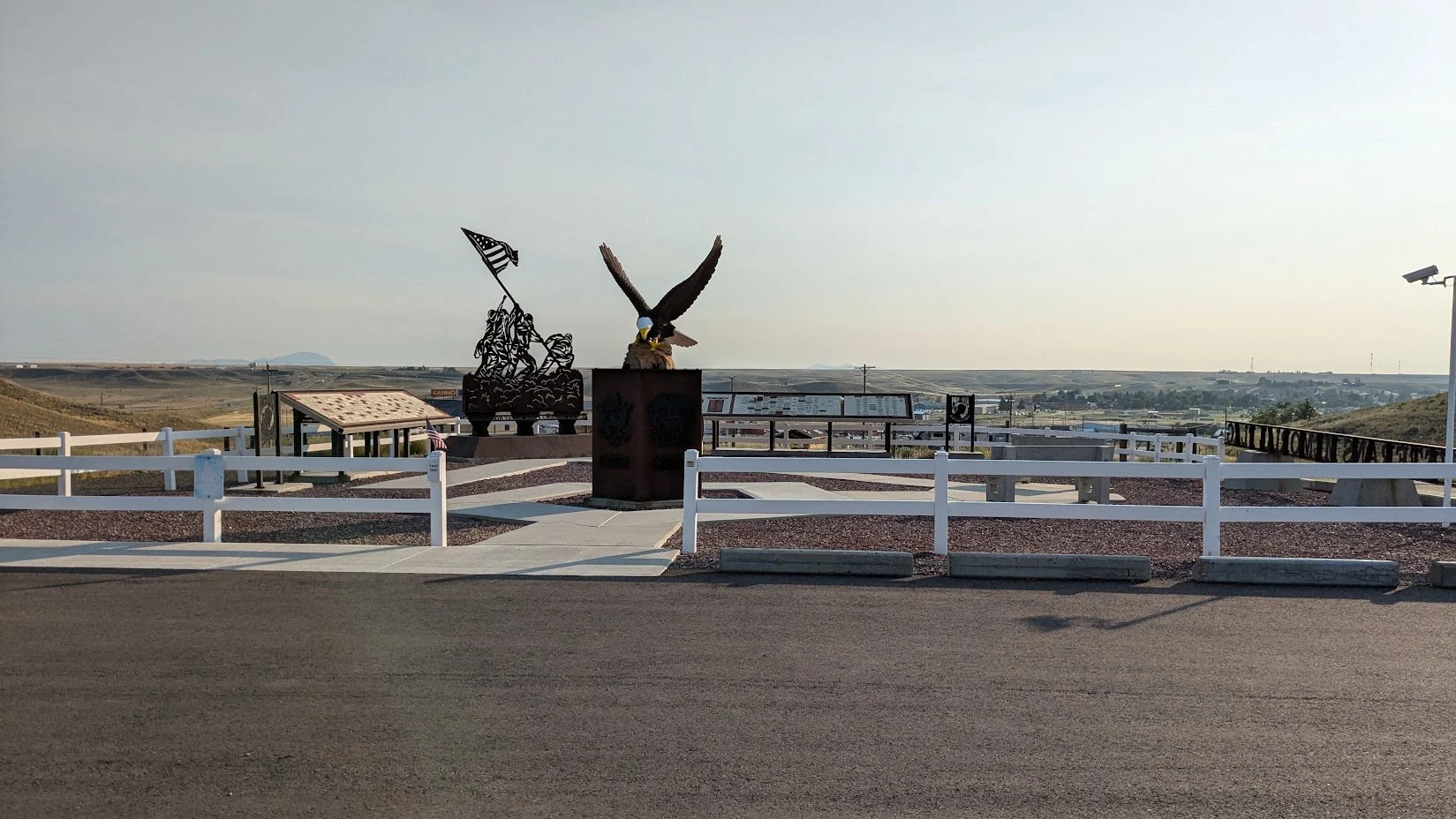
It’s morning and I don’t have to catch my train until 6:20, so I take a hike up the hill that’s behind the hotel, and I’m so glad I did. At the top of the 100-200 ft. hill is an Armed Forces Memorial. There is a big square with a white picket fence around it. At the entrance is a huge Eagle that sits on a shoulder-high pedestal, so the entire sculpture would be approximately 9-10 ft. tall. At the opposite end of the square is another sculpture, this one is of an Armed Forces member raising the American Flag, much in the style of ‘‘Raising the Flag on Iwo Jima.’’ A very moving memorial indeed. And while we’re up here, take a look to the north, we are only 53 Km from Canada.
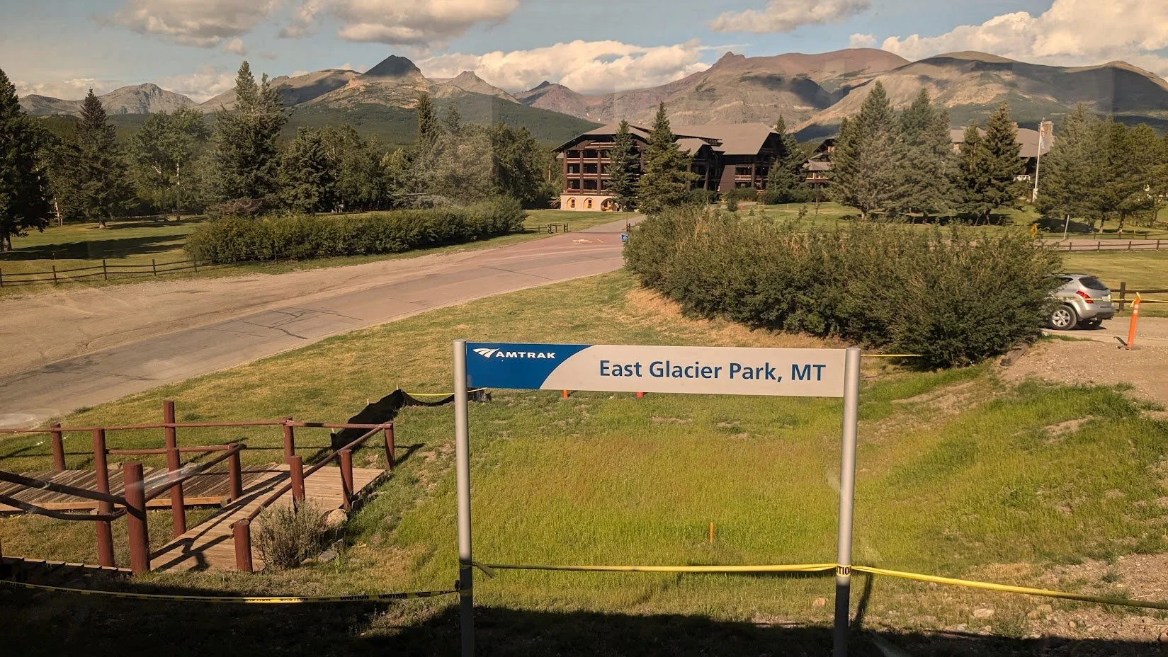
Leaving Shelby, we are getting close to the mountains, and the ground has begun to swell. The rounded foothills are now beginning to take shape, and they grow almost instantly, it seems, into high rocky crags that seem to touch the sky. The sun is just setting as we arrive at East Glacier Park. In the summer, it will still be light enough to see the beginning of the Rockies. Coming from the opposite direction, we would be here around 9 A.M. and would have had some terrific views. As it is, we will regain daylight as we reach Pasco, WA. if we are travelling the Portland, OR, route or when we reach Wenatchee, WA, if we’re headed to Seattle, WA. Having travelled from both directions and gone on both routes (Seattle and Portland), I would have to say that the section of the trip from Pasco, WA to Portland, OR, is the more scenic of the two routes.
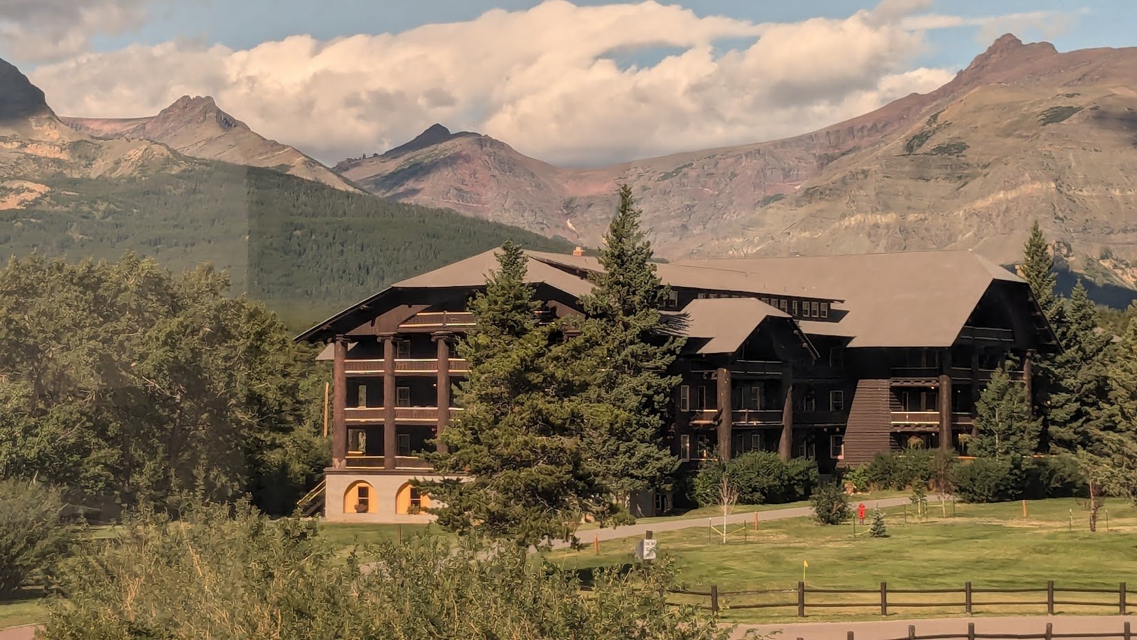
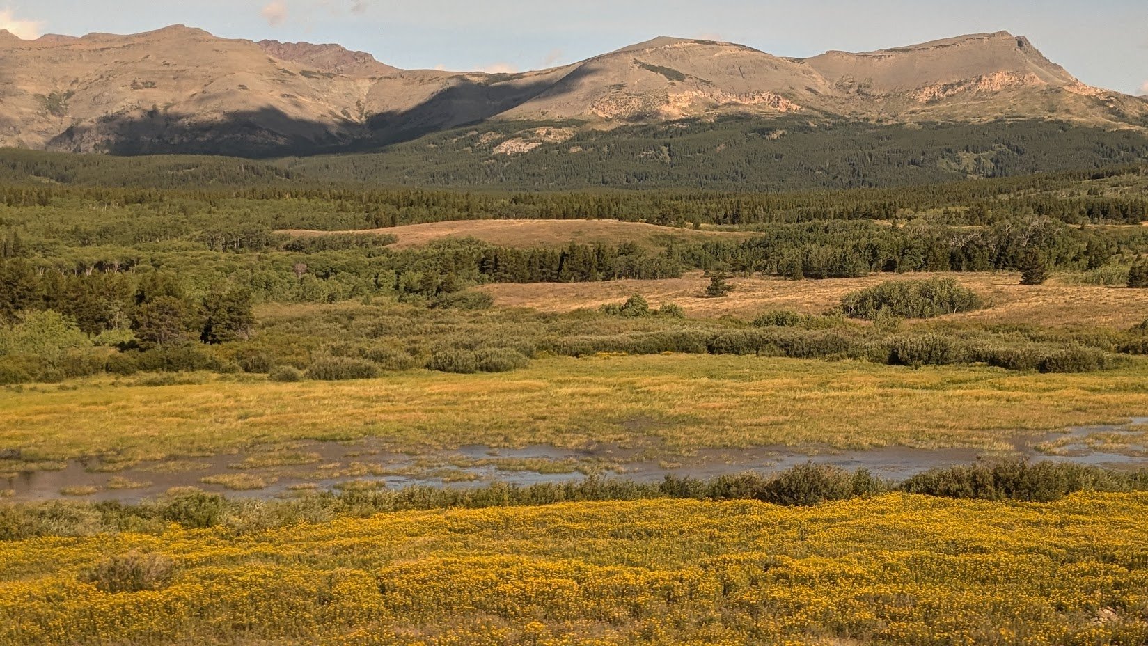
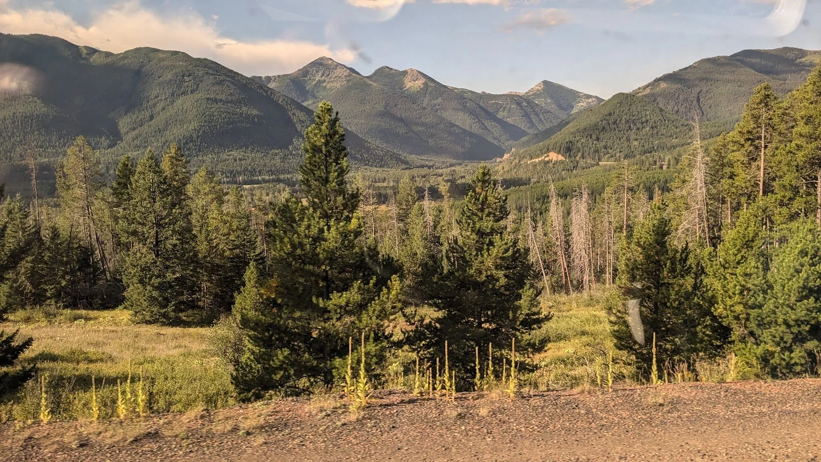
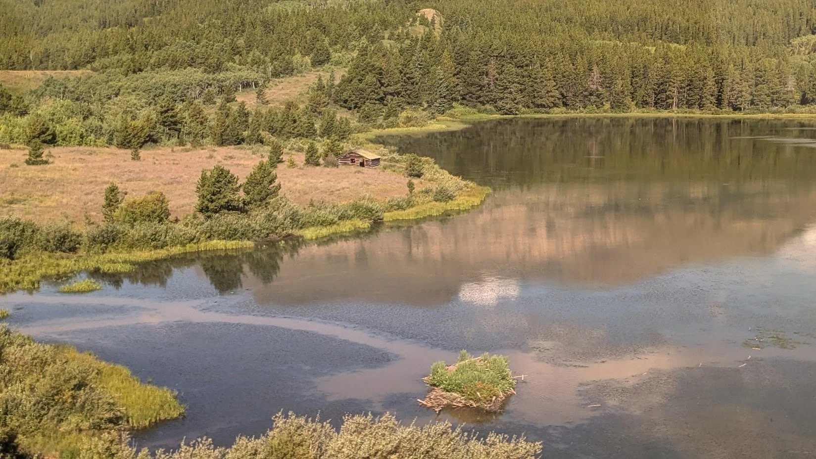
East Glacier Park is our first stop in what would be considered the true Rockies. But just before we get there, watch for the high trestle bridge that takes us over Two Medicine River. The town of East Glacier Park is small, perhaps 3-400 people on a good day; however, the park itself is massive. East Glacier Park covers about 1 million acres and is home to alpine meadows, deep forests, waterfalls, 200 lakes, 10,000-foot mountains, and 50 active glaciers. This area was historically populated by the Blackfeet up to 1895. Some say their name came from French explorers who, having seen the local indigenous people walk through a prairie fire, called them pen wa, the French word for black foot. The town is home to the harmonious Swiss-like Glacier Park Lodge, a scenic wooden hotel which seems to be nestled right into the forested background. How I wish I were ‘‘jumping off’’ here and could spend a couple of days taking in all this alpine area has to offer, but alas, I must save my pennies; this is how I can afford these trips. The scenery is becoming more spectacular as we travel along the southern edge of the park. The park boundary’s mountains are on the right side of the train, though the views on both sides of the train are spectacular. As we continue west through the mountains, we follow the Marias Pass, where 200 years ago, Lewis and Clark searched unsuccessfully for a route through the mountains, although one was finally found in 1887. Here, we also cross the Continental Divide at a height of 5,216 ft. All waters from here flow either east or west, except the 8,020 ft—Triple Divide Peak, where the waters flow to the Pacific, Atlantic, and Arctic Oceans.
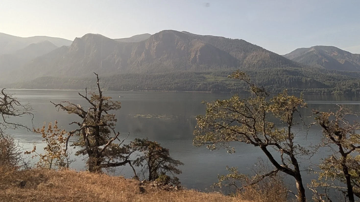
As we continue west, we pass West Glacier Park and Columbia Falls and now follow the Flathead River through a valley of towering mountains lining both sides of the canyon. Needless to say, it is just gorgeous here. Around every bend is another awe-inspiring view of a mountain or a valley being carved out by snaking rivers. I include some pictures for your viewing, but believe me, they do no justice to this magnificent land. You have to see it for yourself. Leaving the mountain town of Whitefish, we follow the edge of Whitefish Lake and enter dense forest areas and soon enter the 7-mile-long Flathead Tunnel, one of the longest in the world. I hope you turned your phone’s flashlight on; otherwise, it’s going to be a long 7 minutes.
Another 2 hours and we cross into Idaho. It’s a short haul because at this northern point, Idaho is only 45 miles across, and we’re actually only in it for a total of 70 miles. The only stop in Idaho is Sandpoint, the midpoint of our journey through Idaho. The northern reaches of Idaho, which we are now travelling, are made up of dense evergreen forests and rugged mountains, with cool wet weather, whereas the southern portion of Idaho is at the opposite end of the scale. It is dry, open, agricultural land in a high desert. This is where a large portion of the nation’s potatoes are farmed, about 30%.
We now follow the Pend Oreille River for 30 miles, where we will cross into Washington at Newport, WA. and will shortly arrive in Spokane, WA. The Empire Builder now splits into two trains for the journey to Seattle, WA and Portland, OR. I have travelled both routes, so I will divide my story here and first take the Spokane, WA to Seattle, WA. route but travelling east from Seattle, WA, to Spokane, WA. Actually, the time I took this route, I flew to Vancouver, BC, from Toronto, ON, and began my journey in Vancouver, so let’s retrace that route, reverse course and go west to east back to Spokane, WA.
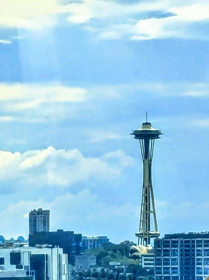
As much as I love travelling by train because of all you can see that you’d never see if you took a car or plane, there are certain times when one needs a bird’s-eye view perspective on things. This is never truer than flying across mountains, and this trip took me right over the best of the Rockies. To see these mountains from 30,000-40,000 feet will give you one of life’s biggest thrills. As far as the eye can see in every direction are snow-capped mountains, which makes this flight well worth the price of admission. The views are incredible right up until we land at Vancouver. We then take an Uber to Union Stn to catch the Amtrak Bus that will transport us to Seattle, WA. This 4-hour drive is another one that’s packed with great scenery. As we head south, we follow a mountain range on our left and the coast on the right. On the left are the Cascades, and on clear days, such mountains as Baker and Rainier may be visible. If you look behind you as we leave Vancouver, the Coast Mountains are visible to the north. We are a bit inland to get many views of the coast, but as we get closer to Seattle, we begin to follow Possession Sound, and then Puget Sound a little further along. It’s very pretty along here, and the area becomes dotted with parks and beaches. A good way before reaching Seattle, the Space Needle becomes visible and makes a great signpost for finding one’s way into the center of the city. So, we come to Seattle’s King St. Stn, which has been Amtrak’s home since 1971. Prior to that passenger service was out of Union Stn. which is in itself a historical landmark and a real feast for the eyes. This is another fine example of a train station doubling as a museum. The architecture is just as grand outside as it is inside. Built in 1911, its architectural style, Beaux-Arts, reflects the time period it was built in. Inside is a high-domed ceiling with a large rotunda beneath the dome. It’s such a shame that it no longer acts as a passenger terminal.
Off we go from Seattle, WA. making our way along the shore of Puget Sound, the views are outstanding. We’re heading in a northerly direction, so looking out the left-hand side of the train, we can just make out bits of the Olympic Range if it’s a clear day, including Mount Constance and The Brothers. We pass quickly through Edmonds, WA, the home of Rick Steves. I bet you that guy never had a trip like ours. Do you think he’d be a bit jealous? On the right side, we get another good look at The Cascades, and the views get even grander as we get closer to Everett, WA. Also, we’re following the Puget Sound once again, so keep a close watch for Orcas pursuing their dinner. Now that it’s early evening, the sun’s reflection on the Sound gives it a golden hue. We go north along the Sound for about 30 miles, then turn east and begin to move toward the mountains.
After 2 ½ hours, we come to our first stop on our eastward journey, Leavenworth, WA, a town modelled to resemble a Bavarian village in Germany. It is well known for its recreational opportunities, including hiking, fishing, swimming, horseback riding, white-water rafting, snowmobiling, and skiing. Yes, Leavenwirth has it all for the outdoor enthusiast. Watch for mountain goats as we pass through Icicle Canyon, and also, deer, elk, and beaver can be seen along here. As we continue our eastward journey, we follow and cross the Wenatchee River several times as it makes its way to the Cascade Ranges. We’re moving through the ‘‘Apple Capital’’ now, so named because this region produces 15% of the nation’s apple crop. Much like Nova Scotia’s Annapolis Valley (my home), the ‘‘Apple Capital of Canada’’. Upon leaving Wenatchee, we enter the Columbia Plateau, and we think we are back out of the ‘‘Great Plains’’ as the land here transforms into an open, semi-arid landscape with broad rolling hills that are filled with wheat fields, sagebrush and ranches. Further east, the land changes again into greener farmland with some forests. This brings us to Spokane, WA, the fork in Amtrak’s Empire Builder route.
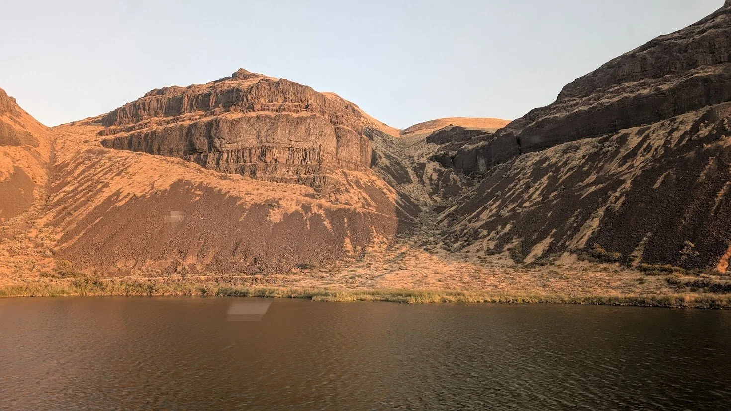
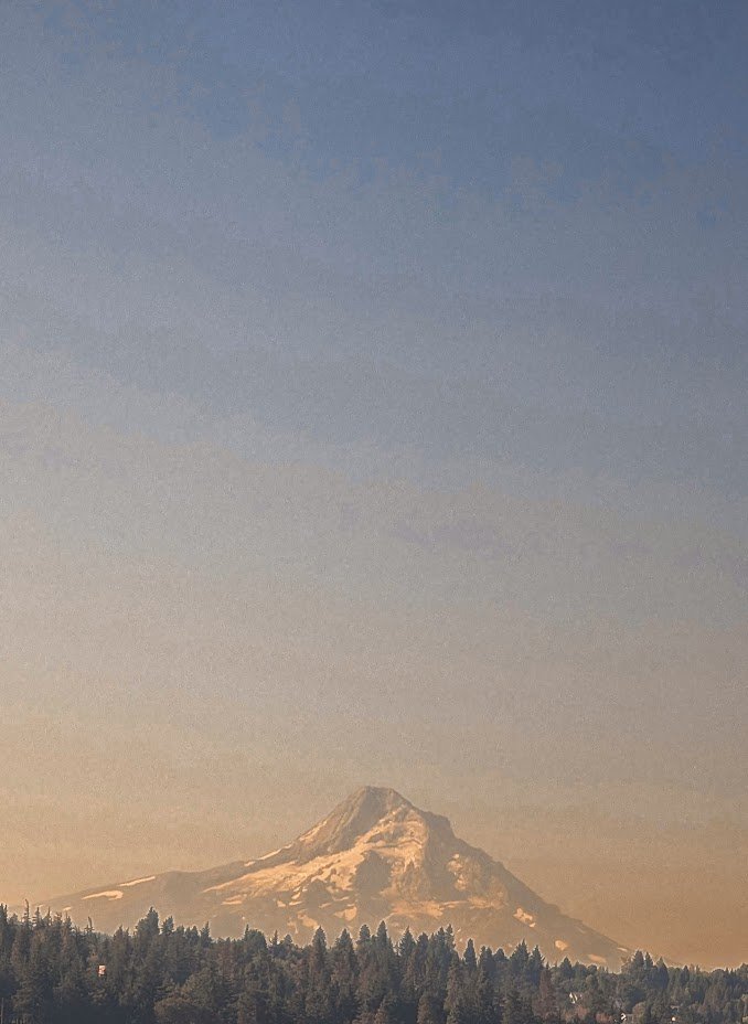
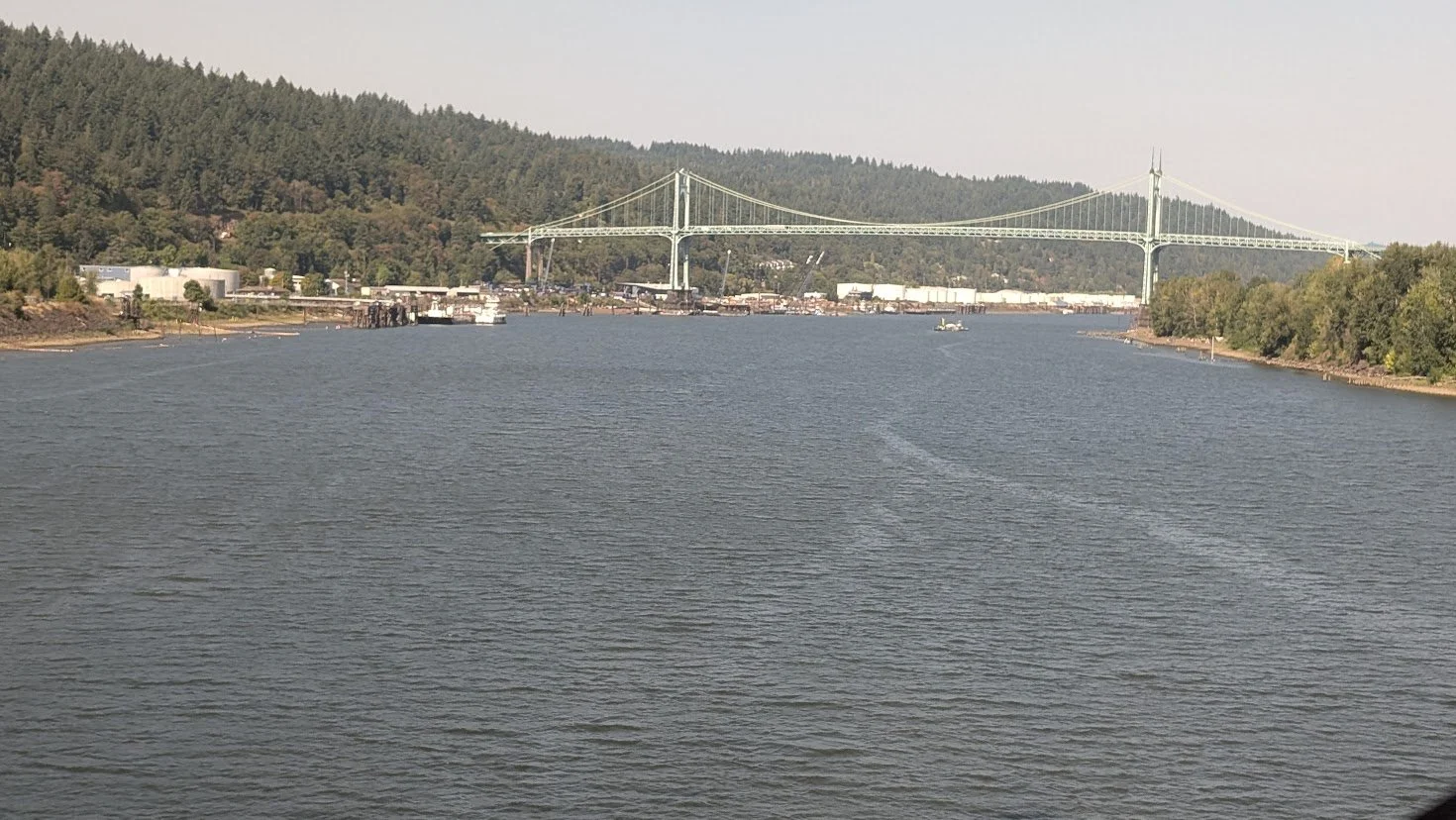
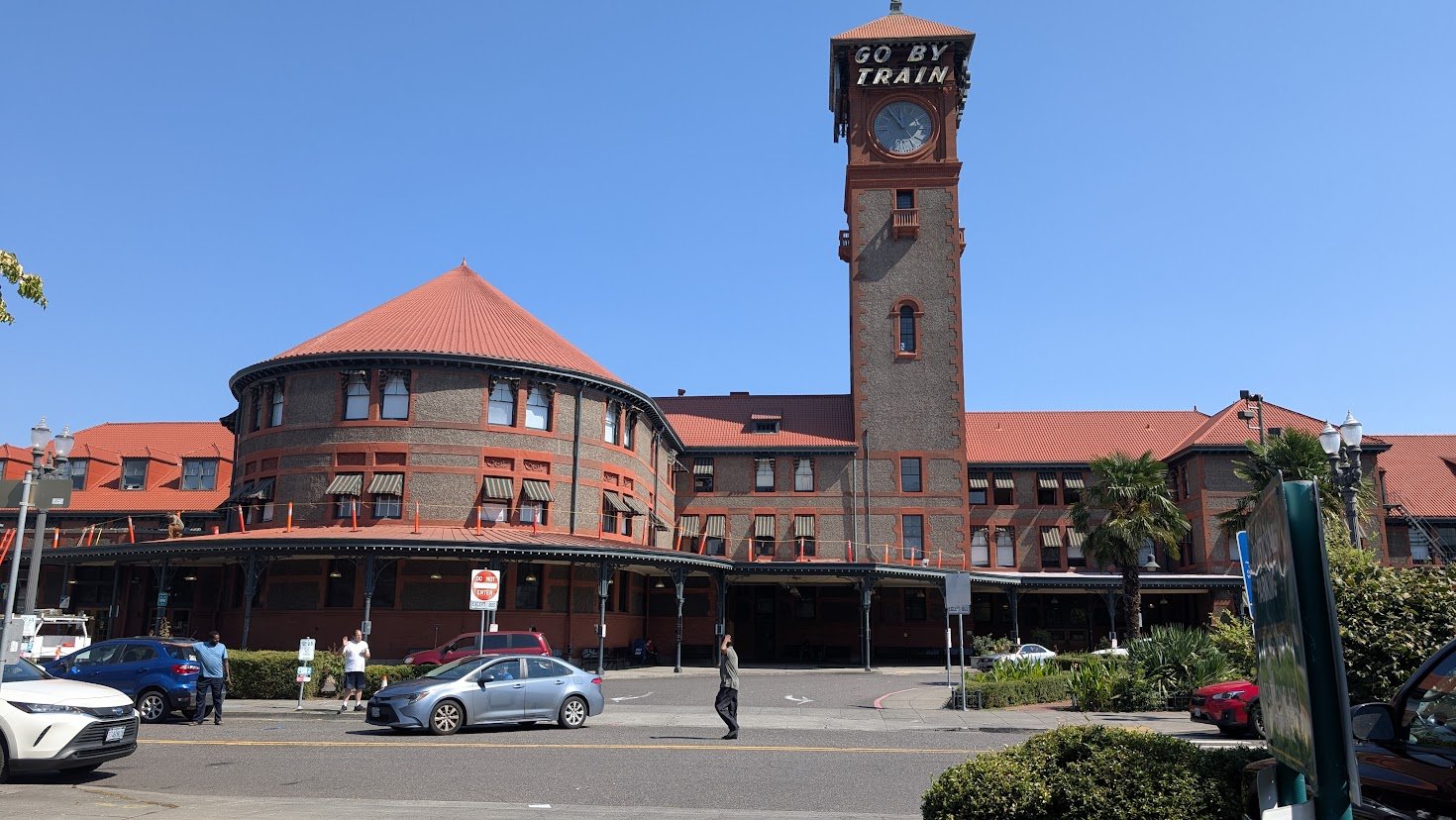
As I mentioned earlier, I am taking you back toward Portland, OR, from our starting point of Spokane, WA. We continue along the Columbia Plateau, only this time we find it made up of steep river canyons and, at times, tall and dramatic ridges. But at the beginning, it is made up of open farmland and prairie with the same geographical landscape we saw on our way east from Wenatchee. We see wide skies and rolling treeless hills all the way into Pasco, which is a surprisingly good-sized city smack dab in the middle of nowhere. Pasco’s population of 300,000 actually comes from Washington state’s Tri-Cities of Pasco, Kennewick, and Richland. Surprisingly, but when you consider that Pasco is the most easterly port on the mighty Columbia River for seagoing ships to transport agricultural produce to worldwide markets, it all begins to make sense. Now, we’re entering the most impressive Columbia River Gorge and will travel along it for the next 55 miles. At first, it is wide and dry, but then it gradually becomes more dramatic. What a beautiful country we are making our way through now. The exposed basalt rocks have a reddish colour to them, and the canyon walls are steep with cliffs and waterfalls all along the way. At points, the river is so wide it would appear to be a lake, and the moist air gives the landscape an ethereal aura, especially where the moisture rises from the large still waters. We are moving along the Washington state side of the river, which splits two states, Washington and Oregon, as well as two National Forests, the Gifford Pinchot National Forest on the Washington side and the Mount Hood National Forest on the Oregon side. Just before exiting the forests you might see Multnomah Falls on the Oregon side of the river. It’s between St. Cloud, WA, and Cruzatt, WA, so ask your car attendant, and they’ll be sure to point out this 2nd. highest falls in the nation. Coming out of the forest, in another 27 mi. we find ourselves on the outskirts of Vancouver, WA. Here is where we cross the Columbia from Washington into Portland, Oregon and the end of one fantastic excursion. But one last thing on our ‘‘to do’’ list. After you arrive at Portland’s Union Stn, take a step outside, cross the parking lot and take a look at this station. It’s one of the prettiest of all the Amtrak stations, in my mind. Its orange-accented windows jump right out at you, and the 15-story tower with the words ‘‘Go By Train’’ at the very top makes this a destination in itself.
What a trip this has been. We’ve just witnessed every sort of terrain imaginable and have seen just how varied this country can be. I hope you have enjoyed this trip. Now it’s up to you to jump on a train and see it first-hand for yourself. If you have enjoyed this travelogue, please join me for more ‘‘travelin’ with bob’’ adventures. Next, we’ll be taking the California Zephyr, which is arguably the most scenic of all Amtrak’s routes.
Find more travelin’ with Bob articles on my website at : https://violet-rose-teyy.squarespace.com/config/website